

Filling the Sensing Gap Above 10m
Filling the Sensing Gap Above 30ft and up to 10,000ft
Traditional in-situ monitoring systems typically stop at or near 30 ft above ground—leaving a critical layer of the lower atmosphere unobserved.
Improving Weather and Storm Forecasting
Early detection of wind shear, boundary layer development, and emerging convection in the lower atmosphere is vital for predicting severe weather events like thunderstorms.
Improving Weather and Storm Forecasting
Ensuring Aviation and UAV Safety
- Many aviation incidents stem from weather hazards not visible at ground level. Clouds, wind shear, icing, or rapidly developing turbulence often emerge within this lower layer — highlighting the need for above-ground observations.
- For drone operations and manned flight alike, real-time vertical profiling enhances safety and situational awareness.
Ensuring Aviation and UAV Safety
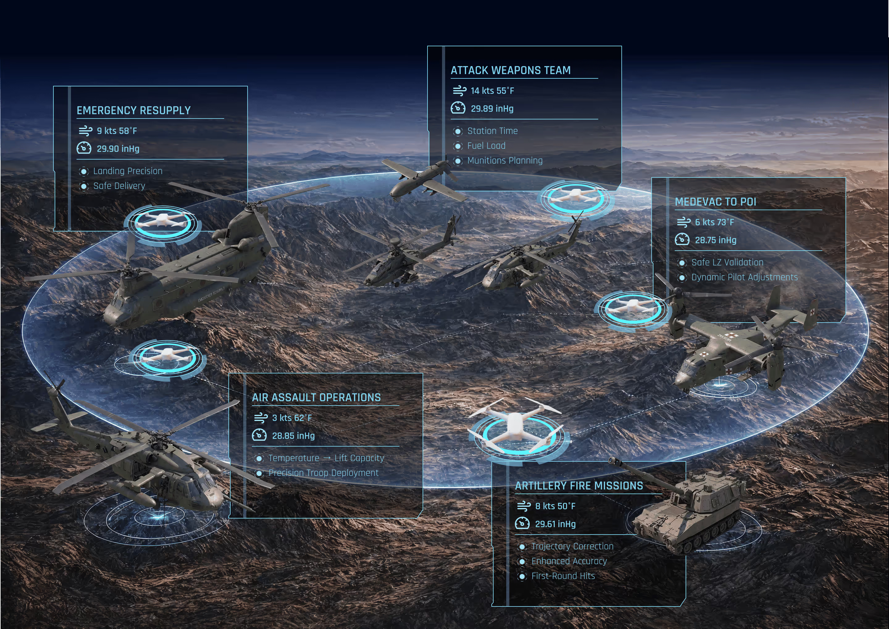
Tactical gaps
in weather
Weather observations often occur on operating bases far from the fight. Combat operations require tactical weather readings at the edge of the battlefield.
Tactical weather applications where Scout Hive thrives:
- Airborne and Emergency Resupply Drops
- Precise artillery calculations (live atmospheric conditions along the entire gun-to-target line)
- Air assault and MEDEVAC to point of injury (LZ/PZ conditions)
- Balloon-less radiosonde alternative
- 3D data for weather model seeding or edge nowcasting
Tactical gaps in weather
Supporting Precision Agriculture
- Agricultural decisions — from planting and irrigation to pest control — depend on understanding microclimatic conditions at the field level, including temperature, moisture, and wind behavior.
- UAS swarms enable dynamic monitoring across varied crop zones, guiding more efficient, sustainable farming practices.
Supporting Precision Agriculture

Systems like radiometers and radar profilers are highly expensive and monitor only a narrow vertical slice of the atmosphere. Mostly used for research, not scalable for operational or business use.
Provide vertical profiles of temperature, humidity, and wind. But they are single-use, labor-intensive, and capture data at only one point in time and space. Subject to the drift of the wind.
Some drones can fly vertical profiles, but they are limited to one aircraft at a time. This restricts coverage and prevents building a 3D picture of the atmosphere.
GreenSight’s Weather Sensing system is transforming the way we observe the atmosphere. At their core are WISP drones — the lightest and smallest weather-sensing drones available. Deployed as a coordinated swarm, WISPs capture simultaneous, multi-level observations of the lower atmosphere, providing data exactly where it is needed and unlocking insights that traditional tools cannot provide.
Compact, ultra-light drones designed for safe operations.
The only solution enabling coordinated fleets of drones to gather data simultaneously.
Captures multi-point observations across different altitudes and geographies.
Designed to operate in extreme temperatures and high winds, ensuring reliable data when it matters most.
Collects far more data per mission than traditional tools or single-drone systems, reducing the cost per dataset.
Scalable and efficient, offering a fraction of the cost of legacy remote-sensing systems.
240mm x 45mm
260 g

Temperature
Pressure
Humidity
2D Wind Speed and Direction
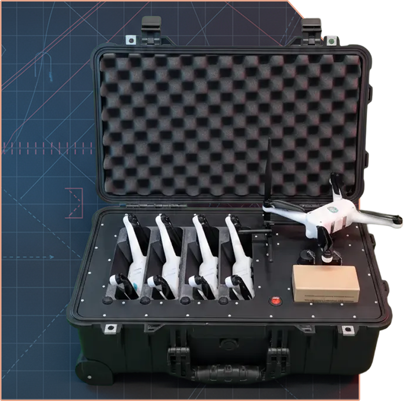
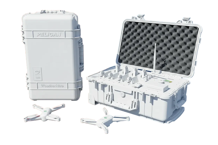
A mobile system with 4 WISPs, engineered for easy transport and off-grid operation without reliance on external power. Perfect for field campaigns, rapid deployment, and remote sensing missions.
Seamless mission control software designed to make weather data collection effortless. With WeatherHive.local, operators can:
Plan missions in advance with intuitive mapping tools.
Launch and manage multiple drones with a single click, enabling synchronized swarm operations.
Easily export datasets into standard formats for analysis, modeling, or integration into existing weather systems.
Vertical integration ensures every component communicates natively, delivering a fully secure and reliable system.
Our technology is NDAA compliant, ensuring the highest standards of security and reliability for government and enterprise use. GreenSight’s weather sensing solutions are trusted by leading organizations, including:
Weather Sensing UAS swarm
Real Object Detection with 3D positioning and awareness in space
Real-time detection and visualization
Attritiable Strike Platform
Long Range One Way Strike Platform
Compact, Deployable Strike Platform
Attritiable Strike Platform
US NDAA compliant flight controller
custom-designed UAS camera payload
modular hybrid electric propulsion system
next-generation generator
Description
Description