Trust & Security Concerns
Trust & Security Concerns
In sectors like the military, users often hold back sensitive data due OPSEC. This makes it difficult to provide actual deployment data for model tuning - resulting in underperforming AI systems.
Poor Real-World Performance
Poor Real-World Performance
Even AI solutions that work well under controlled testing often fail in production. Inconsistent data quality, mismatched expected vs. delivered operational behavior, or lack of ongoing reliability erode performance over time. Up to 85% of AI projects fail to reach production due to such issues. SHARCS is tunable.
Deployment Barriers
Deployment Barriers
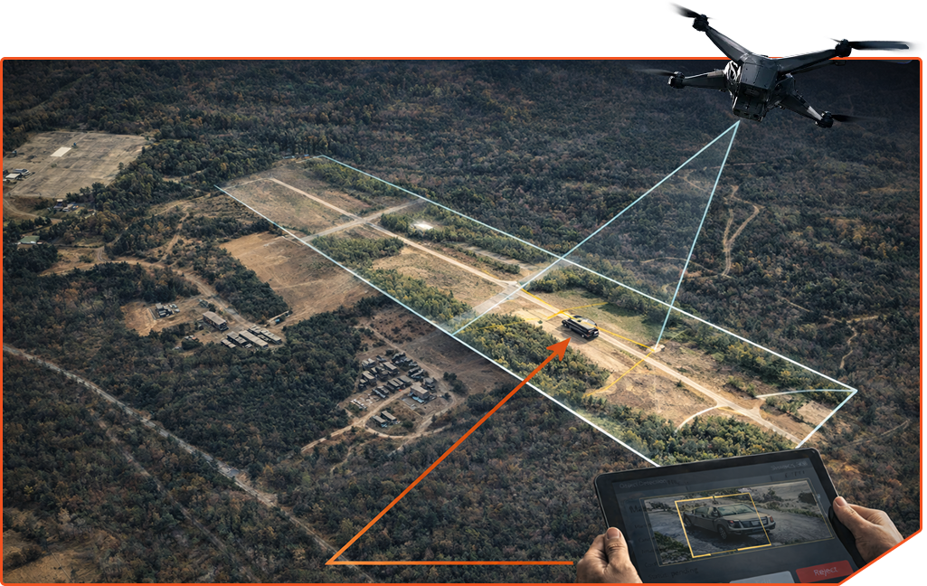
GPS alone provides only meter-level accuracy. Visual systems struggle due to changing vantage points—objects can drift out of view, become partially obscured, or be distorted by perspective as the drone descends.
Data Governance Risks
Data Governance Risks
Sharing sensitive training data raises risks — breaches, compliance violations, or policy infractions can result from improper data handling or centralized access. Alternative solutions like federated learning are emerging but still have complexity in deployment.
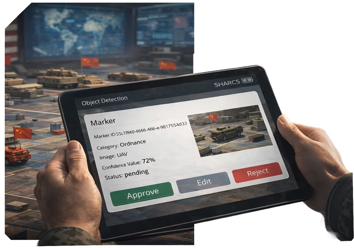
SHARCS, or Super-Human Automated Robotic Classification System, is a modular AI architecture designed to allow users to participate in training AI models themselves through a deep learning training toolkit.
SHARCS
SHARCS has been applied to various image classification tasks, including:
SHARCS integrates seamlessly with ATAK-LM (Android Team Awareness Kit – Live Mapping), extending its AI detection and visualization capabilities directly into the hands of field operators.
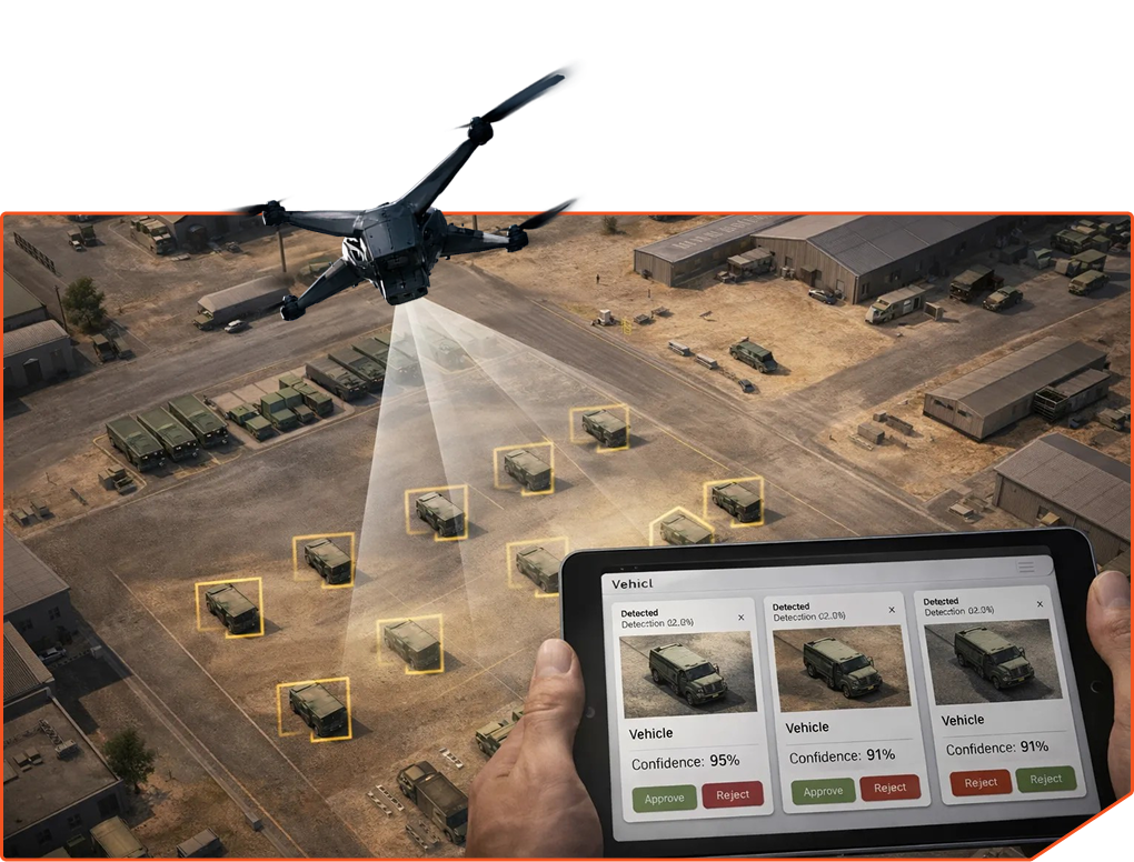
Target Identification & Tracking
Live Mapping
ATAK-LM ingests near real-time imagery from SHARCS and displays detections on interactive maps.
Landing Zone Selection
Enhanced Situational Awareness
Multiple users on Android devices can view the same live updates, georeferenced objects, and system alerts simultaneously.
3D Mapping & Navigation
Field-Ready Integration
Together, SHARCS and ATAK-LM bridge AI-powered detection with mission-critical tools already trusted by defense and emergency response teams.
The system's core components include:
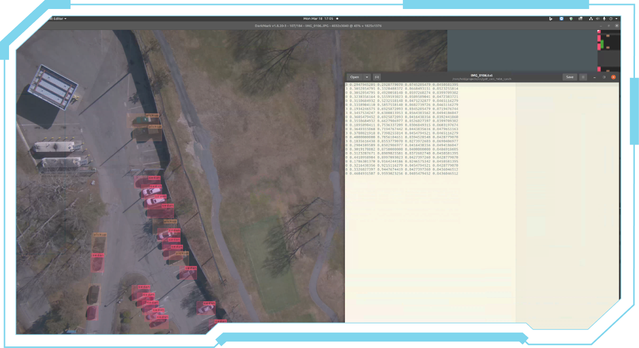
Performs real-time object detection on imagery using machine learning models.
Manages data storage and retrieval, acting as the back end foar the Corrections UI.
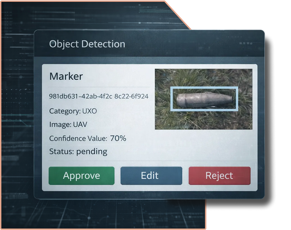
Allows operators to view detections, make corrections, and export them for retraining.
Enhances the accuracy and adaptability of the object detection model by learning from user feedback.
Creates seamless 2D stitched maps from monocular images captured by an onboard camera.
Provides map tiles generated dynamically from real-time ingested imagery.
Enables sending detections to a custom Android Team Awareness Kit (ATAK) plugin for field personnel.
SHARCS has been rigorously tested in real-world operational environments, including:
JIFX (Joint Interagency Field Experimentation) – validating interoperability in complex, multi-user scenarios.
TReX (Test Resource Management Center Experimentation) – ensuring reliability, resilience, and mission readiness.
Weather Sensing UAS swarm
Real Object Detection with 3D positioning and awareness in space
Real-time detection and visualization
Attritiable Strike Platform
Long Range One Way Strike Platform
Compact, Deployable Strike Platform
Attritiable Strike Platform
US NDAA compliant flight controller
custom-designed UAS camera payload
modular hybrid electric propulsion system
next-generation generator
Description
Description